The site should be assessed to identify potential issues that may need to be addressed prior to site closure and release. This assessment would include a records review to make sure any past spills or releases have been closed, a well file review to check for well integrity issues and past inspections that may have required action to repair a piece of equipment or modify a process. This review would be followed up with an on-site inspection to check conditions that may drive additional investigative work. Drivers could include leaks, stains, substandard equipment integrity or poor facility design.
Some regulatory agencies will require that a site investigation be conducted during site closure to ensure that cleanup standards have been met and that the site is not a risk to public health or the environment. Prior to conducting this investigation, a workplan will be developed and submitted to the regulatory agency for review and prior approval. Many agencies will have regulations, guidelines or specific forms to use when developing a site investigation plan, however, a typical site investigation workplan will include a few key components.
- Project Location and Description
- Project Schedule and Reporting Outline
- Sampling and Analyses Plan
Let’s look more closely into the Sampling and Analysis Plan, an important component where impacts to soil or groundwater are known or suspected.
Sampling and Analysis Plan
Proper closure of a production facility, where impacts to soil or groundwater are known or suspected, requires sampling and analysis to determine the horizontal and vertical extent of contamination relative to regulatory cleanup standards. To achieve quality data and results, which can be used to design remedial actions or to close out the site with no further actions, a Sampling and Analysis Plan (SAP) should be developed and implemented. The SAP should include at a minimum:
1. Sample Location Information
- Sample locations should be in areas most likely to have been impacted.
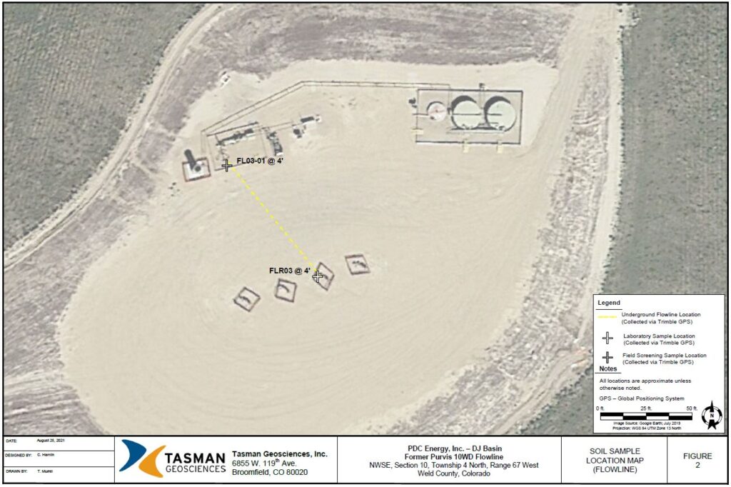
- A map outlining the sample locations and type of samples is important. The figure below shows an example soil sample location map.

A soil sample location map from West Weld County, Colorado
2. Laboratory methods, quality assurance protocols, and detection limits
3. Sample handling procedures
4. Sample description
- Media: soil, water, sediment, sludge, precipitate/scale
- Type: Composite, discrete, grab
- Composite samples are acceptable for preliminary analysis and waste profiling.
- Discrete samples provide the data quality required for confirmation sampling during final closure or for a No Further Action (NFA) determination.
- Grab samples can be used for screening during excavation or managing waste during equipment removal.
- Sample Depth
5. An Investigation-Derived Waste (IDW) Plan that describes how IDW will be managed
- IDW is waste generated from environmental site investigation activities required for determining the presence, extent, and/or nature of known or suspected contamination at a site. Some examples of IDW would be: drilling mud, drill cuttings, purge water from test borings or monitoring well development, excess sampling media, personal protective equipment, and water from decontaminating tooling and sampling equipment.1Idaho Department of Environmental Quality. (2020, November). Investigation Derived Waste.https://www2.deq.idaho.gov/admin/LEIA/api/document/download/14978
Images: “Sample-location-map-Colorado-COGCC” by Colorado Oil & Gas Conservation Commission

