Once hydrocarbons are generated, one of two things can happen:
- In a conventional petroleum system, hydrocarbons that are expelled from the source rock migrate to a reservoir rock, where they either escape at the earth’s surface through a seep or are trapped beneath impermeable rock layers.
- In an unconventional system, on the other hand, the focus is on the remaining oil and gas that are unable to escape the source rock. Instead, they become trapped in the small pore spaces within it. The only way to get the hydrocarbons out is to artificially fracture the rock*, creating pathways along which the gas can travel. In this type of unconventional petroleum system, we aren’t worried about migration and accumulation in a reservoir (the hydrocarbons stay in the same place where they were generated). But we do still worry about preservation of the hydrocarbons after they have been generated.
* We’ll talk about hydraulic fracturing, a method designed to create such pathways, later in this lesson.
Hydrocarbon Accumulation
Let’s focus on what happens to conventional oil and gas after they are generated and expelled from the source material. Where do the hydrocarbons go? How do they become trapped? To answer these questions, let’s take another look underground.
Transcript
Hydrocarbon Origination and Accumulation – Mike Arthur – Penn State
Now that we’ve seen how oil and gas are formed over millions of years, let’s move into the present and look at the question energy companies ask: Where do we drill to find it?
There are two questions that must be answered to find the right spot. Where did the hydrocarbons originate, and where did they accumulate.
Sometimes, hydrocarbons are retained in the source rock that was once that layer rich in organic matter. It stays where it’s made. In those cases, the hydrocarbons are trapped in tiny pores in the rock, like the bubbles in Swiss cheese, but very, very small. This is the case with many shales (those are rock layers made of clay and organic matter mixed together, so little bubbles of gas and oil form in there but they can’t escape.) Those are the kinds of conditions we’ll find in places like the Barnett shale in Texas and the Marcellus shale in the Pennsylvania-Ohio-West Virginia area.
More typically, when a certain variety of conditions exist, these hydrocarbons move laterally and upward out of the source rock (meaning they migrate to other strata). That’s what we’re going to look at now.
As the rock layers bend and contort from the great forces applied to them by landmasses colliding…sometimes they bend into folds called anticlines that look something like this.
Let’s assume for the sake of this story that the hydrocarbons we spoke of a moment ago are in the form of oil and the source of this oil is hundreds of feet below these layers of rock we’re looking at here. As that organic matter liquefies into oil over time, the great pressures exerted by the overlying rock squeeze it upward. These relatively low-density liquids begin to bubble up through tiny fissures and pores in the rock layers until it hits a layer of rock called a seal that has no fissures or pores big enough for the oil to continue its journey to the surface.
This impermeable seal layer is the only reason that the oil stops moving upward.
The anticline that is bounded by this seal is called a trap. The porous rock below the seal is called a reservoir.
The hydrocarbons, which could be oil, natural gas, or other substances, will accumulate in this trap until they reach a point at which the trap can no longer contain their volume and they begin to bypass the initial trap and move upward into an adjacent updip structure, such as another anticlinal feature, that has available volume and porosity to hold them.
As you can see, these pools of hydrocarbons are not large uninterrupted bodies of oil like an underground cavern full of oil, but rather are large volumes of hydrocarbons filling in all the tiny cracks and holes in the reservoir like these. A trap is mostly filled with rock. But due to the scale of some traps, usually much larger than we are looking at here, the volume of hydrocarbons in the cracks and pores of that rock can be huge.
As you saw in the video, petroleum geologists are interested in learning two important characteristics about a petroleum system: where the hydrocarbons originated and where they are now.
The migration of oil and gas is controlled by both the stratigraphy and structural geology of a region. Porous layers known as reservoir rocks can store large volumes of hydrocarbons. Depending on their permeability, certain stratigraphic units can serve as migration pathways that allow the flow of hydrocarbons, or they can serve as barriers that impede it. Geologic forces can change the geometry of these pathways and may form a structural trap that prevents oil and gas from further migration.
Let’s take a closer look at the role of stratigraphy and structural geology in petroleum systems.
Reservoir Rocks
A reservoir rock is a permeable rock with a high porosity that is capable of storing large amounts of oil and gas in its pore spaces. Reservoir rocks are most often sandstones and limestones, though smaller amounts of oil and gas can also be stored in the fracture systems of non-porous rocks (e.g., fractured granite).
As you saw in the video, oil and gas reservoirs aren’t large underground caverns. Instead, hydrocarbons are stored in the spaces between the individual grains of a sedimentary rock. Depending on the diversity of grain size or the amount of dissolution within a rock, the total pore space could range from 5% to 50%.
Most reservoirs are contained within sandstones and limestones. Sandstones typically range in porosity from 5%-30%, depending on the size of the grains and how well sorted they are. Limestones have an even higher range of porosities, often a result of dissolution (i.e., vuggy porosity), with values from zero up to 50%.
A rock with 50% porosity can hold 10 times more oil than one with 5% porosity. Given the huge range of porosities and permeabilities, it’s not surprising that geologists spend a lot of time and money characterizing reservoir rocks.

Seal / Caprock

Once oil and gas enter a sandstone or limestone, they begin to migrate upwards. This movement is because they are lighter (i.e., more buoyant) than the briny water that is common at depth. Unless they become trapped by an impermeable rock layer, they will continue to move upward until they escape at the surface in tar pits, oil seeps, and methane vents. Fortunately, there are many types of rock capable of stopping the migration of oil from depth. These rocks are referred to by petroleum geologists as caprocks or seals. They are characterized by low permeability and horizontal continuity.
The most common caprocks are shale, chalk, and salt. In contrast to sandstone and limestone, these rocks have very low permeabilities. Very few rocks are completely impermeable, but as long as the rate at which hydrocarbons accumulate beneath a layer is greater than the rate at which they can escape, oil will build up beneath the seal.
Traps
If oil encounters a horizontal caprock layer, it will simply flow along the bottom of the layer until it can find a path to the surface. Because of this fact, the mere presence of a cap rock is not enough to prevent oil from reaching the surface. This can only be prevented if an effective oil trap exists. An oil trap requires several conditions:
- An impermeable layer is located above a reservoir rock.
- The impermeable layer has a geometry that traps rising hydrocarbons.
- This trap existed at the time of hydrocarbon migration, thus allowing for accumulation.
- The trap has not been breached between accumulation and the drilling of the well.
Hydrocarbon traps can be created under a variety of conditions. We’ll cover six types here, and they fall into two major categories: Stratigraphic and structural.
Structural Traps
The structural trap category includes anticlines, fault traps, and salt dome traps.
Anticlines are iconic representations of reservoirs. In an anticline trap, a folded layer of impermeable rock traps rising hydrocarbons. Anticlines form as a result of tectonic forces. An anticline can be illustrated like this:

A fault trap occurs when layers of potential reservoir are sealed by vertical movement of stratigraphic units caused by tectonic forces. Hydrocarbons are trapped in the permeable layer as they rise from deeper source units. A fault can serve either as a flow path for migration or a barrier for accumulation, depending on conditions. When a fault serves as a barrier it can form a fault trap illustrated like this:

The third type of structural trap is called a salt dome. Thick layers of salt are laid down in shallow salty seas and sometimes form thick stratigraphic units. Salt is a relatively pliable rock that moves like thick fluid (i.e., plastic flow) over a long period of time. Sometimes it tries to push its way to the surface, bending surrounding layers of rock into a dome-shape. This upside-down bowl can trap hydrocarbons if a good cap rock is part of the overlying stratigraphy. You will see salt domes illustrated like this:

Stratigraphic Traps
The next three types of traps fall under the category of stratigraphic traps. The reason for this nomenclature is that these types of traps occur due to the way the original rock layers were laid down rather than due to folding, faulting, or tilting after the fact.
The first of these is called a lens trap. Lenses are formed when a meandering river carves out a channel and deposits sediments in it, then moves across the floodplain to a new channel depositing a new lens of sediments there. The porous channel lenses get buried by finer material during flood events, eventually subside, and over time may trap hydrocarbons and become quality reservoir rocks. There are lots of lens systems in the American West. They get their name because of their shape when viewed from the side. In the drawing below, the porous lenses are full of oil and surrounded by nonporous material that traps the oil from escaping:

A pinchout trap occurs when the layers forming the trap are laid down at different inclinations and create contiguous nonporous facies that seal off a porous layer. If migrating hydrocarbons are able to enter the porous layer, they will travel upward until they meet the seal. A pinchout trap might look like this:

Finally, an unconformity trap occurs as a result of possible combinations of tilting, folding, erosion or lack of sediment deposition in the geologic past. For example, in an angular unconformity hydrocarbons are trapped in a tilted porous rock by nonporous layers above, below, and to the sides. An angular unconformity trap represents tilting and / or folding of layers containing a porous formation, followed by erosion and subsequent deposition of a nonporous formation. This specific type of angular unconformity trap might look like this:

Timing and Preservation
Imagine that a geologist has found a perfect source rock that appears to be overlain by a reservoir and a trap. Study of the temperature history shows that the rocks have been in the oil window for a long time. The geologist draws an x on a map and a hole is drilled. After drilling for a few weeks, operators reach the reservoir rock. To their surprise, they find that there’s no commercial oil or gas down there. Why not? There are a couple of possibilities. The first is that the anticline trap didn’t form until after all of the oil had migrated out of the source rock – an issue of timing. Another possibility is that the oil slowly leaked from the trap through time – an issue of preservation. Both of these examples demonstrate that petroleum occurs within a system. Not only do the right events need to occur – they also need to occur in the right order and at the right rate, and we have to be lucky enough to arrive on the scene at the right time. Because of the importance of timing, petroleum geologists invest a lot of time and money into determining the geologic history of a potential oil field.
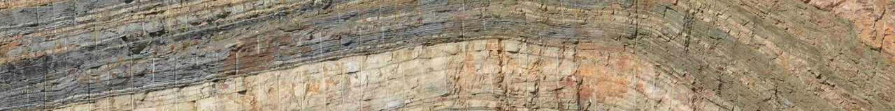
Images: “Road Cut” by Top Energy Training; “Red and white sandstone & chalk cliffs” by ChrisPole via iStock; “Illustrations” by Top Energy Training