
In the 1970s, a revolution in geologic thinking occurred. Scientists began to accept the idea that the surface of the Earth is composed of multiple plates, which can move relative to each other. Plate tectonics, as the theory was called, explained previously enigmatic features such as mountain ranges, basins, and earthquakes.
Plate tectonics also had a big impact on our understanding of petroleum geology.
Let’s take a closer look at the underlying concepts of plate tectonics.
Transcript
Plate Tectonics – Hilary Olson – The University of Texas at Austin
There’s a fundamental geological theory that serves as kind of a backstory for a lot of the things that we talk about in the energy sector, and especially in geology. That concept is plate tectonics.
I think everyone has heard of that so I’ll give a very brief overview. Suffice it to say that the rigid surface of the planet, composed of the Earth’s crust and rigid uppermost mantle, is made up of many large sections that move around.
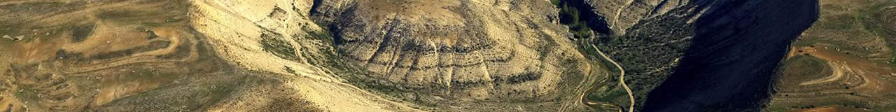
In the places where one plate is colliding with another, we often have mountains like the Himalayas. While in regions where plates are sliding past each other we may have features, such as rivers, split across the boundary, as we see with the San Andreas Fault.
At places where two plates are separating from each other, we develop what we call rifts, which begin as valleys, like the East African Rift Valley, and eventually can grow to be the size of oceans, like the Atlantic Ocean. Sometimes people refer to these valleys associated with early rifting as grabens.
Tectonic movement is responsible for all kinds of things: the burial and uplift of hydrocarbon source rocks and the formation of anticlines and synclines that serve as hydrocarbon traps. It’s responsible for volcanic activity and earthquakes too, but one of the biggest reasons that energy companies care about it is that the movement of plates can set up conditions ripe for hydrocarbon development. Let’s take for example rifting.
As plates continue to separate and the rift valleys deepen to form ocean basins, the margins of the valleys eventually form the edges of continents where rivers carrying sediments come out into the ocean. These sediments could become reservoir rock.
These basins fill up with huge layers of organic matter, hundreds to thousands of feet thick at certain times in history, and given millions of years, produce some serious hydrocarbon-bearing systems.
For explorationists, people who try to identify sources of oil and natural gas, understanding the history of tectonic movement has been integral to their success. It has led them to old rift valleys and continental margins because of those perfect conditions I mentioned, and they have discovered enormous reservoirs of both oil and gas all around the world in the places where plates have been moving apart.
Examples of rift valley related source rocks include those that can be found beneath the North Sea Graben Provence between the U.K. and Norway. This rift-associated region has produced billions of barrels of oil and trillions of cubic feet of natural gas.
Reservoirs with great potential in the deep offshore of Brazil are related to the opening of the South Atlantic. With all we know about plate tectonics, it is only natural for explorationists to think about analogous reservoirs on the African side.
So you see that all those lessons on tectonic plate movement you had when you were a kid were important and relevant!
The geologic history of Earth – the tectonic movement of continental plates – is a prime factor in generating unbelievably large amounts, hundreds of trillions of dollars worth, of economic activity in our lifetimes.
Plate tectonics plays a major role in almost all aspects of the history of oil and gas. Rift valleys and other subsiding geologic structures related to plate tectonics allow sediments to pile up to great thicknesses without filling the basins they are deposited in. This answers our earlier question about thick deposits – as long as sediments are deposited at a slower rate than the basin is subsiding, they won’t fill it up.
Plate tectonics allows for the deposition of incredibly thick layers of sediment. But it also serves many other important roles in petroleum geology.
For one thing, if there were no tectonic forces there would be no mountain ranges to produce sediments. Erosion would have planed down the continents long ago, leaving nothing but flat plains. Without sediments, there would be no sedimentary rocks, and, ultimately, no oil or gas.
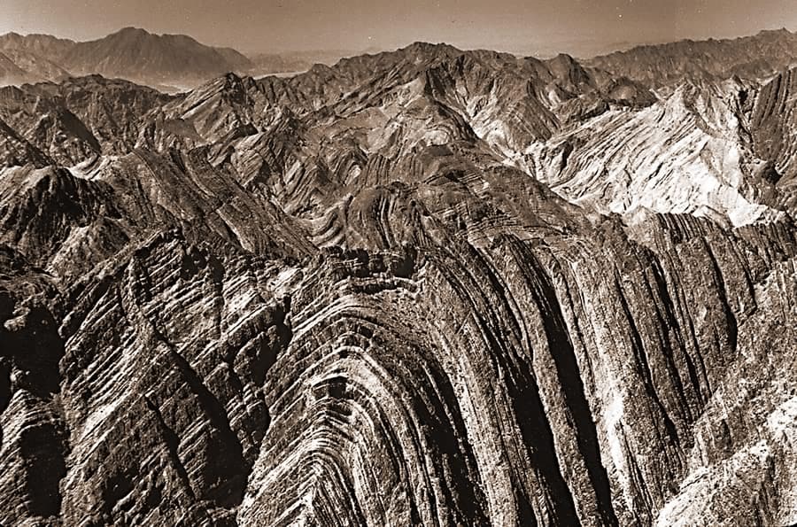
Tectonic forces also cause rocks to bend and fold. The geologic structures created by these movements can trap oil and gas, holding it in place until humans extract it.
Folds and Faults
There are two main types of geologic structures: folds and faults.
Folds
A fold consists of a layer of rock that has been bent around a certain axis. There are two basic types of folds, synclines and anticlines. In a syncline, beds slope down towards the central axis (making a v shape). In an anticline, beds slope down away from the central axis. Anticlines are the most important folds to geologists because their geometry can trap rising oil and gas.
Faults
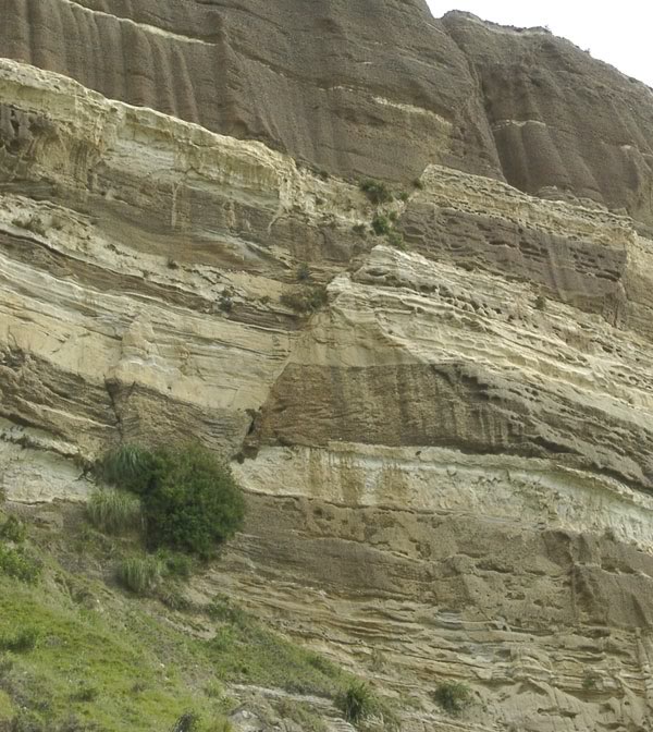
Faults occur when rocks break apart and move along a surface. By placing an impermeable rock layer above a permeable layer, faults can also trap rising oil and gas. Faults are sometimes geologic hazards capable of producing earthquakes.
We’ll get into the practical aspects of recognizing and mapping geologic structures in the petroleum exploration section.
First, let’s bring geologic structures, sedimentary basins, and stratigraphy together to tell the geologic story of oil and gas formation.
Images: “Panoramic desert landscape with San Andreas Fault – from Joshua Tree National Park in California” by Ryan DeBerardinis via Shutterstock; “Folding Gasteretal” by Woudloper licensed under CC BY SA 1.0; “Geological fault” by mikeuk via iStock