In order to improve cross sections, geologists augment their knowledge of surface geology with data collected from beneath the surface. For example, when a borehole is drilled, samples are collected at regular intervals. These samples, combined with data collected by sensors lowered down the hole, provide absolute knowledge of the depths of geologic contacts between layers at the location of the borehole.
Let’s use some imaginary borehole data to revise our cross section.
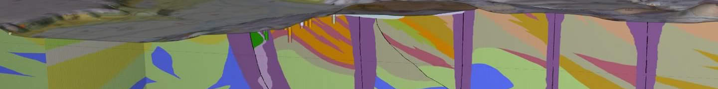
The colors within the vertical box represent the depth at which the drill bit encountered each unit. As you can see, drilling revealed that the contacts between units are not where we thought they were.
In fact, according to the drilling data, the red unit seems to repeat three times!

When we compare the results of drilling with our cross section, we can see that they don’t match up with what our existing model predicts. A new model that is compatible with the new data will have to be developed.
One possible solution to the inconsistency might look like this:

The new model is more complex, but it more accurately matches the data. An experienced geologist has an understanding of the geologic processes occurring in a region, which allows him or her to reject implausible models. For example, this structure is typical of a fold-thrust belt, a specific geologic setting. A geologist working in such a geologic setting would be predisposed to interpret underground structures in a way to makes sense given what’s already known about the local geology.
Geophysical data provide additional constraints to cross sections and models. Geologists become skilled at utilizing all the data at their disposal to create an accurate model.
Images: “3D Geologic Model” by Washington State Department of Natural Resources; “Illustrations” by Top Energy Training